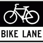
 The City of Providence has finally completed the long awaited Broadway Bike Lanes. Announced in 2008 as coming soon, and rumors of imminent milling and repaving, 2011 sees the city complete its current bike plan with the installation of this lane, adding 2 lane miles to the city’s inventory.
Below are photos taken during a ride down the lanes over the last couple of weeks with the final striping and stencils in place. Other amenities along the street are signs at the intersections indicating that bicycles should be placed on a not yet present line in the line at intersections. Presumably these will line up with the induction loop sensors that have been installed in the lane.
While the lane is short and not particularly connected to any other bicycle specific amenities at this time, I would expect that with the pending project to revise the city’s bike plan, the Broadway bike lane will become an integral part of that network.
From observation, east bound drivers on Broadway coming from Olneyville and Route 6 aren’t entirely comfortable with the new striping and the appropriate route/lane shift to get into the right turn only lane onto Barton Street. At this location, the bike lane beings and is striped at an angle from the curb to occupy a position between the straight and turn only lanes (see photo below). On the 3 occassions I’ve traveled through, I’ve seen cars stay to the left of the bike lane and then change lanes across the bike lane to make the right turn as they near the light rather than changing lanes through the “dashed lines”.
The lanes aren’t perfect, appearing to be approximately 4 feet wide, located adjacent to a parking lane. This leaves it possible for a person leaving a vehicle to endanger a rider by opening their door into the lane. Given the narrowness of the street and other travel lanes, a wider bike lane or a striped buffer would not fit into the footprint of the street, however, so it’s difficult to see how the street design could have been much different.
There are one locations where the lane disappears on the East bound track, leaving the rider with a sharrow in the straight lane between Bainbridge Ave and Tobey St. At this location a left-turn only lane is present, and straight traffic is shifted to the right, causing the auto and bike lane to merge for the block. The lane resumes immediately after the Tobey Street intersection. The lane also ends without warning or accommodation at Ringgold Street with no lane markings or sharrows for the last block to Dean St, where the new paving ends. The street configuration doesn’t appear to have changed for this block, with no dedicated turn lanes add yet, making it not obvious why the lane ends at that location.
West bound the situation is similar, with the lane ending at Harkness St. to accommodate a right turn-only lane onto Tobey. Sharrows are placed in the straight through travel lane. The bike lane doesn’t resume until Bainbridge St., and finally ending at Barton St. West bound also has one extra hazard, not present in the opposite direction, manhole covers that are frequently set an inch or so below the level of the paving. There seems to be one in every intersection, and several extras.
Discussions and additional photos can be found on posts at Greater City:Providence and CarFreePVD.

